21st Century Dutch Landscapes
Koert van MensvoortFor centuries the Dutch landscape has been known for its highly cultivated formal structure, however with the introduction of Google Maps a whole new layer of formalization has been added.
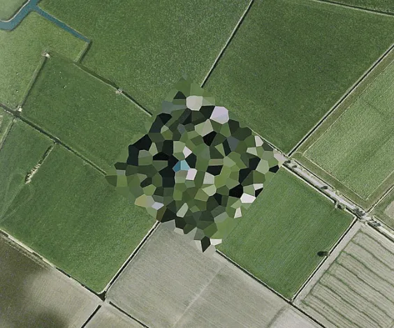
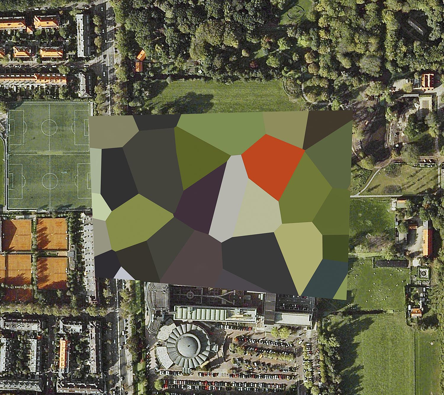
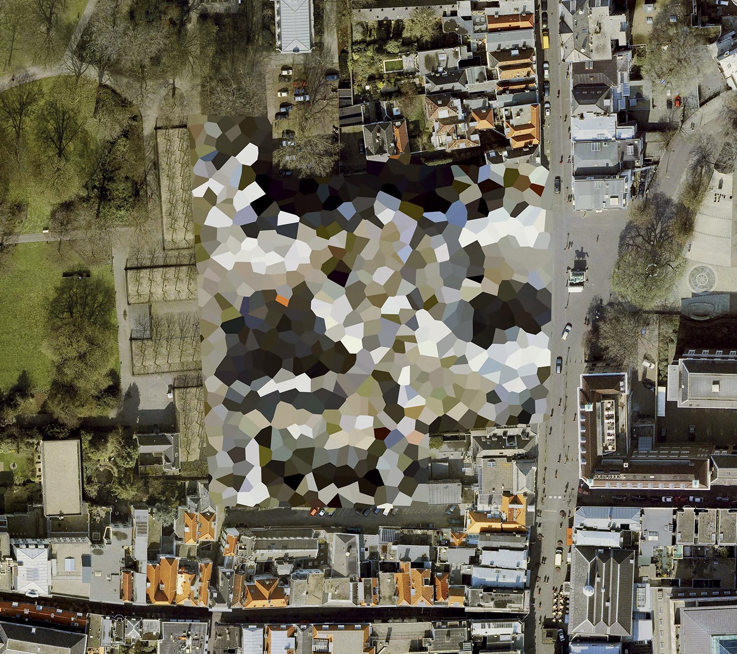
Like many other governments the Dutch censor the visibility of political, economic and military locations on the satellite imagery, but while most countries blur, pixelate, and whiten out sites of interest, the Dutch method of censorship is notable for its stylistic intervention of bold, multi-coloured polygons over sites. The result is a landscape occasionally punctuated by sharp aesthetic contrasts between secret sites and the rural and urban environments surrounding them.
The satellite images where collected by Mishka Henner.
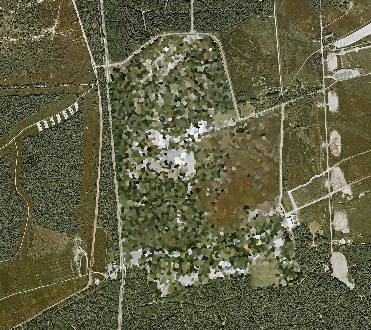
Artillery shooting range - 't Harde, Gelderland
Koningin Beatrix Kazerne, Den Haag, South Holland
Noordeinde Palace, Den Haag, South Holland
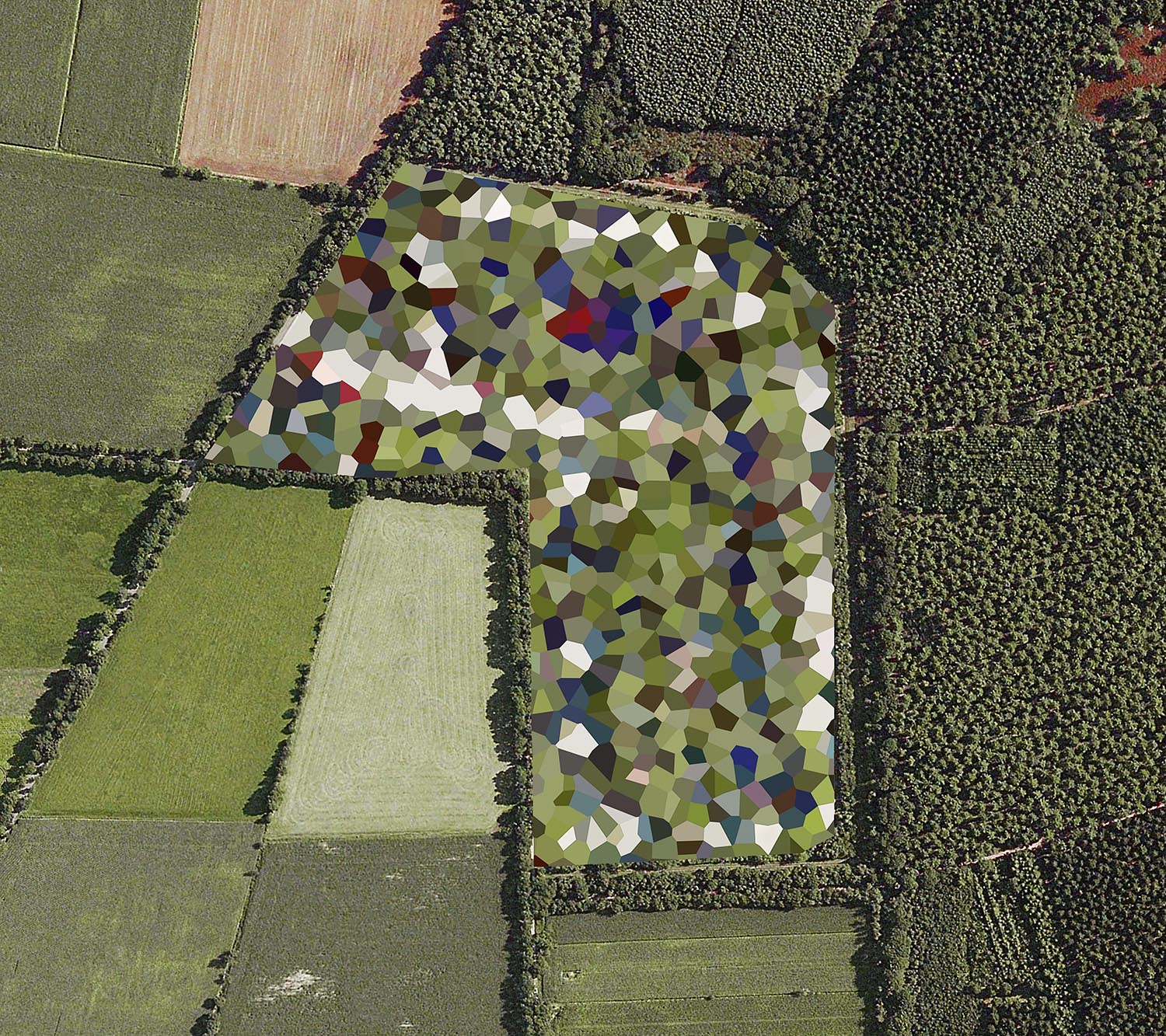
Staphorst Ammunition Depot, Staphorst
More images at mishkahenner.com
Comments (0)
Share your thoughts and join the technology debate!
No comments yet
Be the first to share your thoughts!