
Unfolding the Earth - Myriahedral projections
Koert van Mensvoort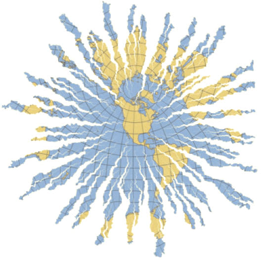 How can we unfold the Earth? Making a map of the earth is an ancient problem. For thousands of years cartographers, mathematicians, and inventors have developed methods to flatten the curved surface of the earth into a 2D plane. The main problem is that you cannot do this perfectly, such that both the shape and size of the surface are depicted properly everywhere, hence the result is never neutral.
Visualization professor Jack van Wijk developed a new method of unfolding the earth: Myriahedral projections. The idea is take a map of a small part of the earth, which is almost perfect, glue neighboring maps to it, and repeat this until the whole earth is shown. Of course you get interrupts, but does this matter?
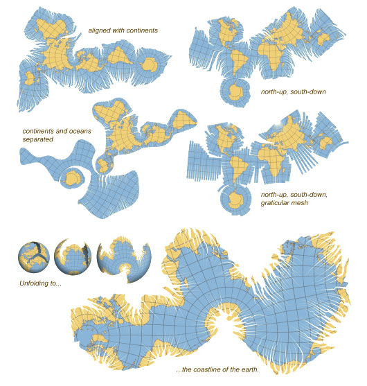
The video below shows ten variations, which tend to get stranger and stranger.
Read the entire paper by Prof. Dr. ir. Jack van Wijk: Unfolding the Earth - Myriahedral projections (pdf). Related posts: World View, Atlantis turns out to be interfacial artefact, Earth rise on Youtube, To boldly Google.., Sequoiaview.
Comments (0)
Share your thoughts and join the technology debate!
No comments yet
Be the first to share your thoughts!